
If you find errors OR have additional information about this site, please send a message to contact@waynehistorians.org.
Underground RR Historic Marker
| Historic Site #: | 06-009 (Exists) Type: B2,F2 | Town: | Macedon | ||
| Site Name: | Underground RR Historic Marker | GPS Coordinates: | 43.04403, -77.34081 | ||
| Address: | SW Corner Wilkinson Rd.& Victor Rd | ||||
| Description: | |||||
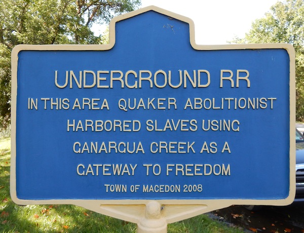 |
| Photo from Macedon Historical Society Website |
| Historic narrative: | |||||
| UNDERGROUND RR IN THIS AREA QUAKER ABOLITIONIST HARBORED SLAVES USING GANARGUA CREEK AS A GATEWAY TO FREEDOM | |||||