
If you find errors OR have additional information about this site, please send a message to contact@waynehistorians.org.
Abbey Park & Lyons Aqueduct
| Historic Site #: | 05-047 (Exists) Type: B4,I1,K5 | Town: | Lyons | ||
| Site Name: | Abbey Park & Lyons Aqueduct | GPS Coordinates: | 43.06371, -77.00298 | ||
| Address: | 177 West Water Street, Lyons, NY | ||||
| Description: | |||||
| The site of the remains of an Erie Canal Aqueduct | |||||
 |
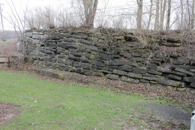 |
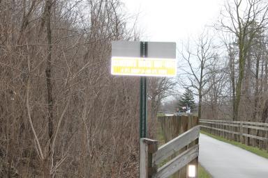
| On east side of Abbey Park, trail along Clinton's Ditch to Hotchkiss Museum (used with permission LA Jorgensen) | Remains of aqueduct abutment on east side of Ganargua Creek (used with permission LA Jorgensen) |
 |
 |
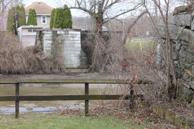
| Remains of aqueduct abutment on west side of Ganargua Creek (used with permission LA Jorgensen) | Interpretive map of Abbey Park (used with permission LA Jorgensen) |
 |
 |
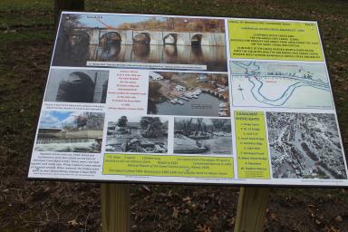
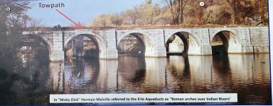
| Interpretive Panel Image 1 - July 2022 | Interpretive Panel Image 2 - July 2022 |
 |
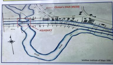 |
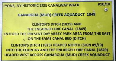
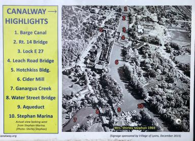
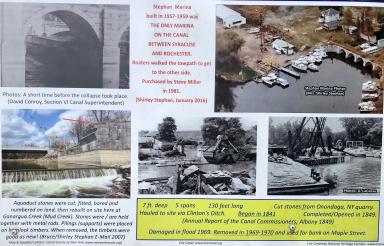
| Interpretive Panel Image 3 - July 2022 | Interpretive Panel Image 4 - July 2022 |
 |
|
| Interpretive Panel Image 5 - July 2022 |
| Historic narrative: | |||||
| The original Erie Canal, Clinton's Ditch, traveled along the east side of Ganargua Creek and curved east into Lyons. The second, Enlarged Canal, traveled just north of the current canal and over Ganargua Creek via an aqueduct. The aqueduct was completed in 1849. It was damaged and collapsed in a storm in 1969-1970. | |||||