
If you find errors OR have additional information about this site, please send a message to contact@waynehistorians.org.
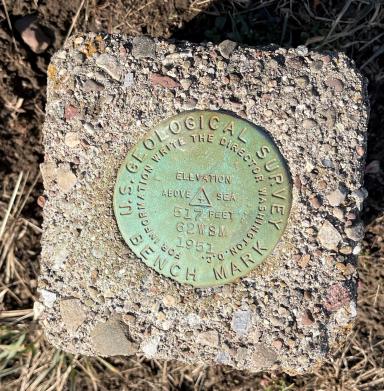
United States Geological Survey Benchmark
| Historic Site #: | 07-084 (Exists) Type: B3,B4 | Town: | Marion | ||
| Site Name: | United States Geological Survey Benchmark | GPS Coordinates: | 43.1671653673405, -77.2485927489651 | ||
| Address: | Corner of Hall Center Rd and Goosen Rd | ||||
| Description: | |||||
| United States Geological Survey Benchmark Elevation 517 feet above sea level date: 1951 | |||||
 |
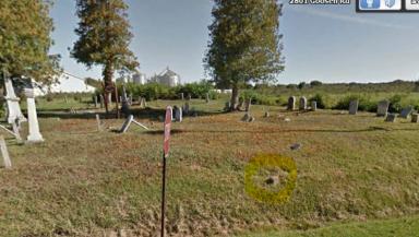 |
| US Geological Benchmark | Wide view Hall Center Cemetery |
| Historic narrative: | |||||
| This marker was set in place to mark the elevation from sea level in 1951. | |||||