
If you find errors OR have additional information about this site, please send a message to contact@waynehistorians.org.
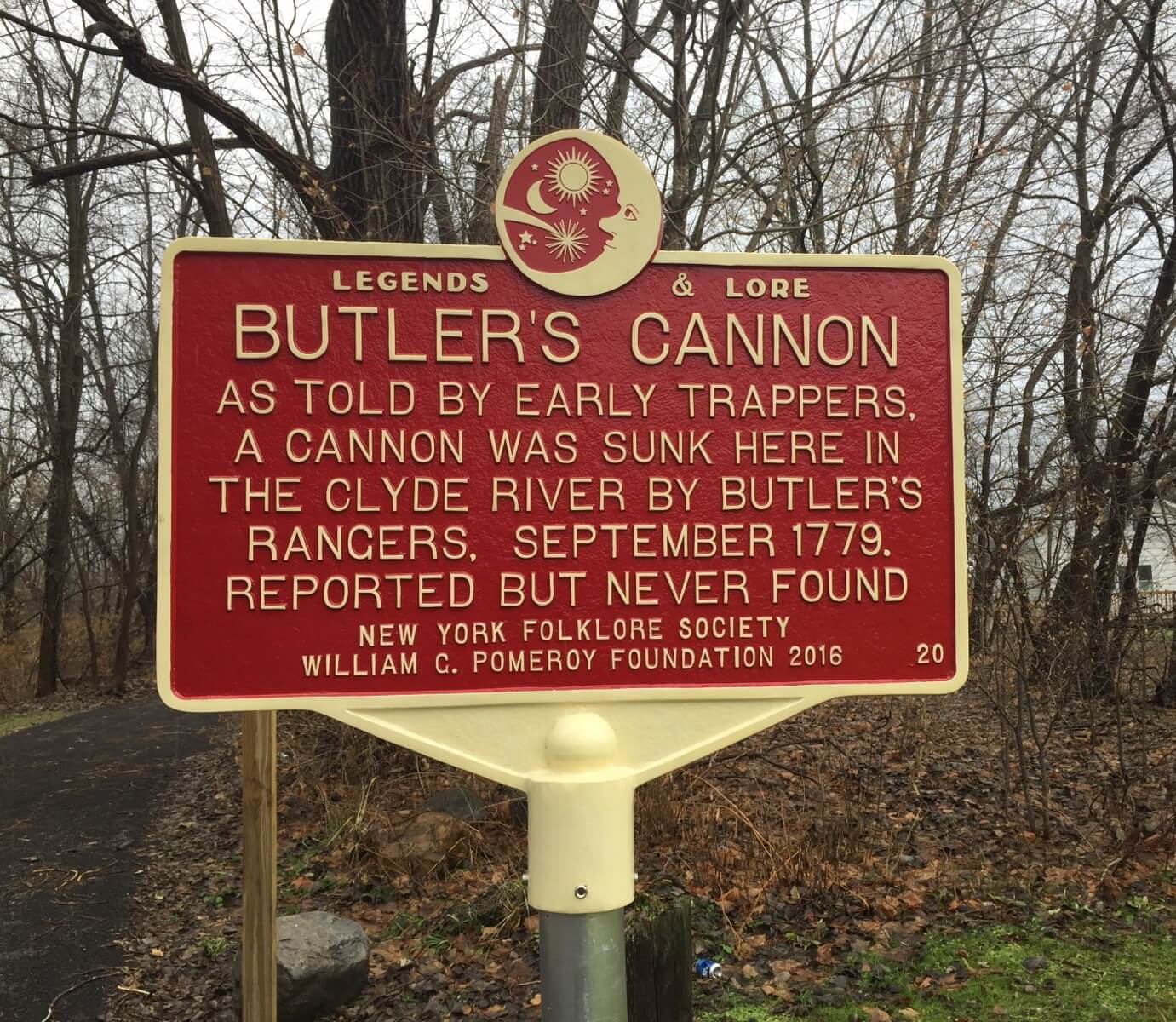
Butler's Cannon Historic Marker
| Historic Site #: | 03-094 (Exists) Type: B2,J6 | Town: | Galen | ||
| Site Name: | Butler's Cannon Historic Marker | GPS Coordinates: | 43.088549, -76.889547 | ||
| Address: | 10420 NYS Route 31, Clyde, NY | ||||
| Description: | |||||
| This marker is part of the Pomeroy Foundation's "Legends and Lore" program. The traditional blue and yellow markers require primary source documentation requiring "proof" of the information on the marker. That was not possible with this marker, but there is substantial information about this, so it does qualify for this type of marker. | |||||
 |
| From the Pomeroy Foundation website |
| Historic narrative: | |||||
| During the Revolutionary War Sullivan-Clinton Campaign of 1779, a cannon belonging to Loyalist unit Butler’s Rangers was said to have been sunk intentionally by them during a retreat from Lake Ontario or by Americans at Melvin Brook (Clyde River) west of the Village. There were reports from early trappers, pioneers and boatmen who claimed to see the cannon. Lore suggests that one man reported putting his hand on the muzzle. About 1840, a group of residents set out to locate the cannon, but never found it. This legend can be found in both the “Military History of Wayne County” and “Morrison’s History of Clyde.” | |||||