
If you find errors OR have additional information about this site, please send a message to contact@waynehistorians.org.
First National Paper Manufacturing Company
| Historic Site #: | 03-092 (Gone) Type: H2 | Town: | Galen | ||
| Site Name: | First National Paper Manufacturing Company | GPS Coordinates: | 43.0829506667749, -76.8681446797015 | ||
| Address: | Ford Street. (GPS - approximate) | ||||
| Description: | |||||
“In 1866 the First National Paper Manufacturing Company of Clyde was organized, with Dr. Darwin Colvin, president. He erected a building and the industry had a weekly capacity of nine tons of manilla wrapping paper. After running about two years, at a heavy loss, First National Paper Manufacturing closed. (p.273, Landmarks of Wayne County, by George Cowles, 1895) First National Paper Manufacturing mill was located on Ford Street in Clyde. Clyde Paper Manufacturing Company | |||||
 |
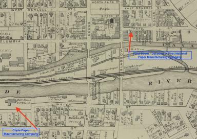 |
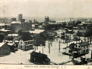
| Mills between Ford Street and the Erie Canal. | Section of Village Map of Clyde from 1874 Wayne County Atlas - D. G. Beers. |
| Historic narrative: | |||||
The following information about milling in Clyde was gleaned from Cowles, from Clyde history publications by Wayne Morrison, a couple of sentences (but insightful) from Grip’s history of Clyde (1905), and some old maps. The story of manufacturing in Clyde in the 1800’s has milling at its core. As early as 1818, Major Frederick DeZeng was building a dam across the Clyde River in order to have water power to run a saw mill on the north side of the river and a grist mill on the south side of the river. The grist mill would be one of many to follow. Wheat was the major crop grown for the next fifty years because it could be ground into flour at a grist mill or it could be more coarsely ground to make animal feed. Cowles’ Landmarks of Wayne County (1895) tells us that in 1843, the major milling interests in Clyde were just two grist mills and one saw mill. That would change. By 1851 there was a steam powered grist mill, which was later converted to a distillery. That would not be unusual, as many of the milling structures might be a grist mill one year, then a malt house or a brewery or a distillery. Wayne Morrison’s History of Clyde, New York (1955) tells us “In 1877 Clyde had 7 malt houses which were processing 228,000 bushels of grain a year.” As many as four of these malt houses were located on Ford Street. A major reason for that location was that one end of the building faced Ford Street while the opposite end faced the Erie Canal, which ran through the middle of Clyde . A few other mills were located just west of the canal and river bridges and would also face the Erie Canal. Malt primarily uses barley grain and is one of the main ingredients for making beer (along with hops, yeast and water). Since the barley needs a lot of room to be spread out and moistened, just long enough for it to sprout, and then dried, it is not surprising that malt houses were large buildings. Postcard views of Clyde show several of these large buildings. Agriculture would shift in the final quarter of the 1800s and the new emphasis would be a mix of fruit, vegetables and dairying. The Hemingway Canning Factory was a major employer. The Clyde Creamery was a major stop on the railroad as butter became an important export. Flour and feed mills were still busy but there was only one major maltster left. Along with the railroads (Clyde had two at the end of the nineteenth century) the shift of the Erie Canal to the Clyde River, closed the route of the canal through the middle of the village and made the immense milling buildings no longer on the major transportation route to and from markets. | |||||