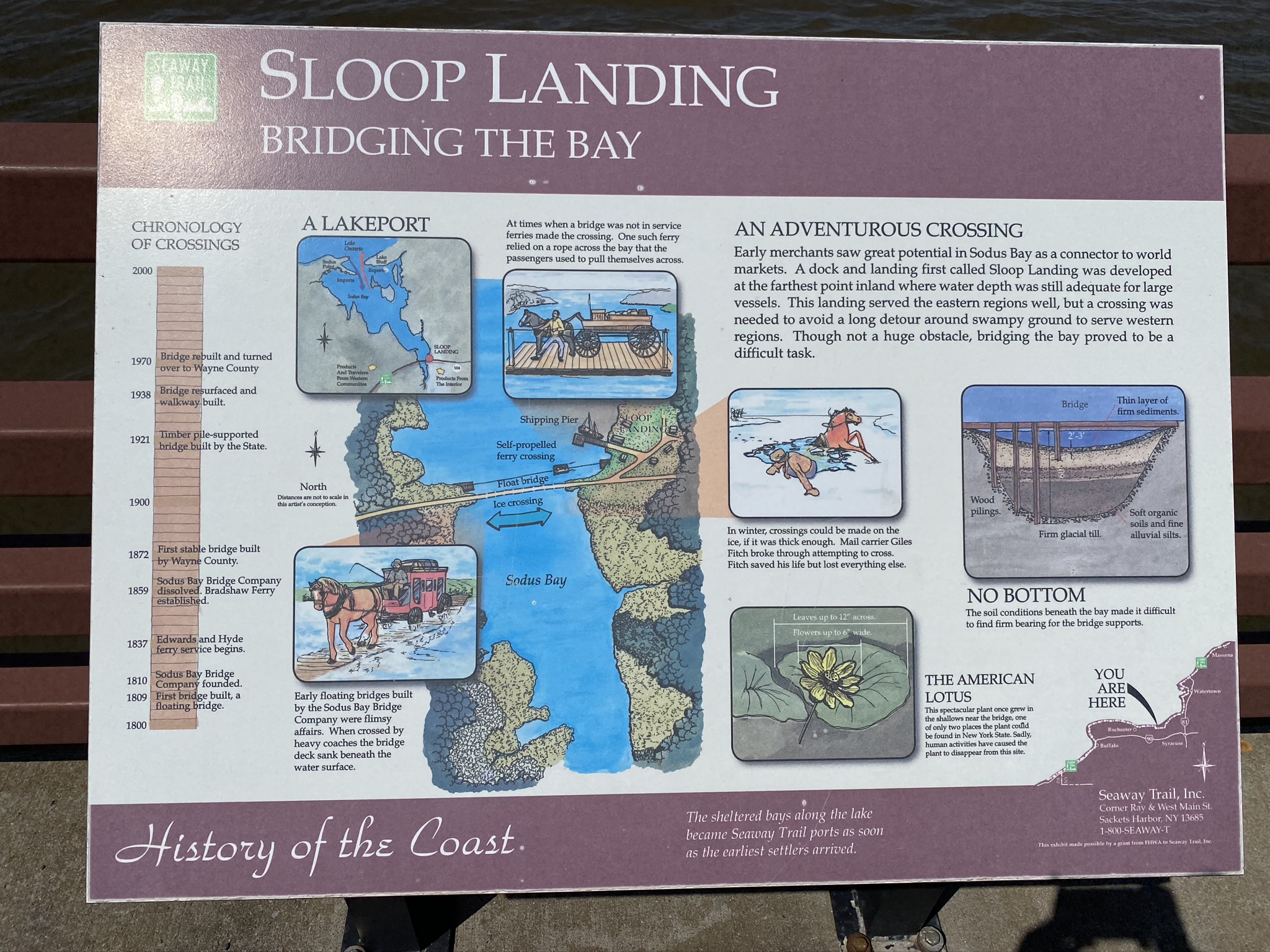
This New York State Seaway Trail marker provides a pictorial hostory about the head of Sodus Bay at Bay Bridge: an overview of the history of methods employed to cross the bay at this point, the wonderful Lotus Lily - now lost on the bay since the 1960s, a mention of Sloop Landing and shipping at this location. For additional information on Sloop Landing, please see an article by the Town of Huron Historian, written after extensive research on the location of Sloop Landing - linked below on this site. Please note: The sign is on the eastern end of Sodus Bay Bridge - along the walkway on the north side of the bridge.
Sloop Landing Historical Article
|