
If you find errors OR have additional information about this site, please send a message to contact@waynehistorians.org.
Dickson Hill Interpretive Sign
| Historic Site #: | 03-086 (Gone) Type: B4 | Town: | Galen | ||
| Site Name: | Dickson Hill Interpretive Sign | GPS Coordinates: | 43.079904, -76.87227 | ||
| Address: | 16 NY-414 Clyde NY | ||||
| Description: | |||||
| From Dickson Hill, now covered in trees, one can look northward across the Erie Canal, as well as east and west. See the 1892 Birds-Eye View of Clyde by A.B. Defendorf for the Burleigh Lithographing Co. of Troy. | |||||
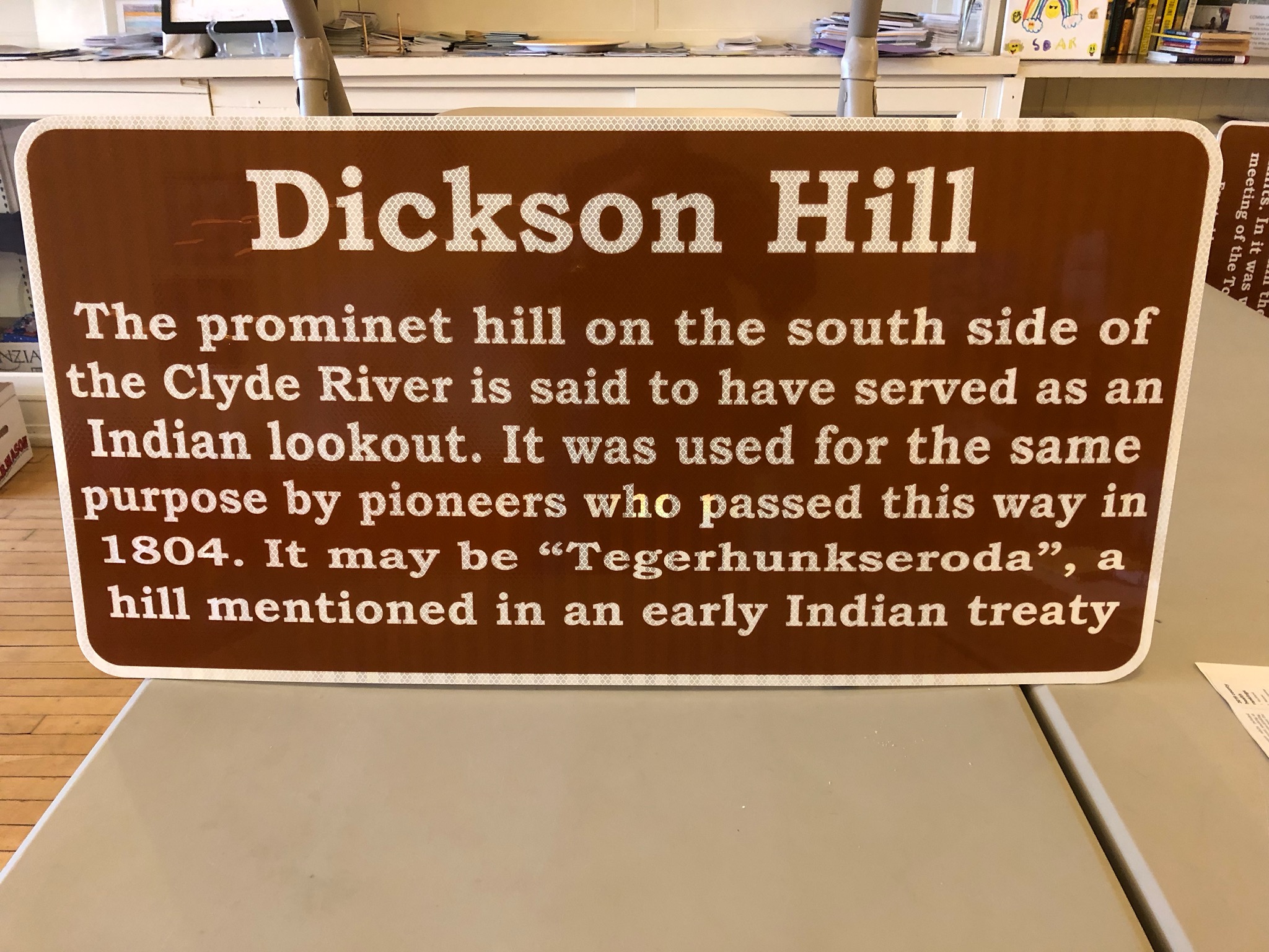 |
| Photo by Tom Sawtelle 2019 |
| Historic narrative: | |||||
| The marker states: Dickson Hill The prominent hill on the south side of the Clyde River is said to have served as an Indian lookout. It was used for the same purpose by pioneers who passed this way in 1804. It may be "Tegerhunkseroda", a hill mentioned in an early Indian treaty | |||||