
If you find errors OR have additional information about this site, please send a message to contact@waynehistorians.org.
Clyde River Interpretive Sign
| Historic Site #: | 03-085 (Exists) Type: B4,I0 | Town: | Galen | ||
| Site Name: | Clyde River Interpretive Sign | GPS Coordinates: | 43.079807, -76.868274 | ||
| Address: | 24 Water Street Clyde NY | ||||
| Description: | |||||
| The Clyde River was variously navigable or not, depending on the season. In the early decades of the 1800's, it had a dam and a mill. It was too wide and, westward, too winding to accommodate the Erie Canal. Steam Power and dredging made the river useful for Barge Canal Traffic. The winding portion was avoided when straighter portions were dug. | |||||
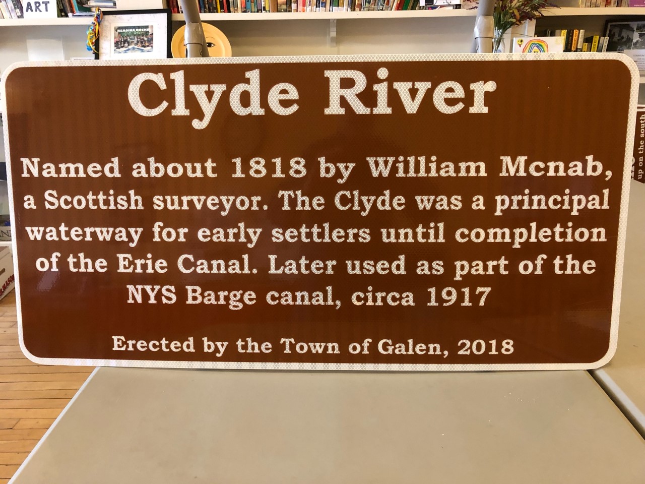 |
| Photo by Tom Sawtelle 2019 |
| Historic narrative: | |||||
| The historic marker states: Clyde River Named about 1818 by William Mcnab, a Scottish surveyor. The Clyde was a principal waterway for early settlers until completion of the Erie Canal. Later used as part of the NYS Barge canal, circa 1917 | |||||