
If you find errors OR have additional information about this site, please send a message to contact@waynehistorians.org.
Lauraville Interpretive Sign
| Historic Site #: | 03-084 (Gone) Type: B4 | Town: | Galen | ||
| Site Name: | Lauraville Interpretive Sign | GPS Coordinates: | 43.080175, -76.869975 | ||
| Address: | 26 Water Street Clyde NY | ||||
| Description: | |||||
| Lauraville, now the south side of the Village of Clyde - south of the Clyde River, was settled about 1811 before the north side of the river was settled. | |||||
 |
| Photo by Tom Sawtelle 2019 |
| Historic narrative: | |||||
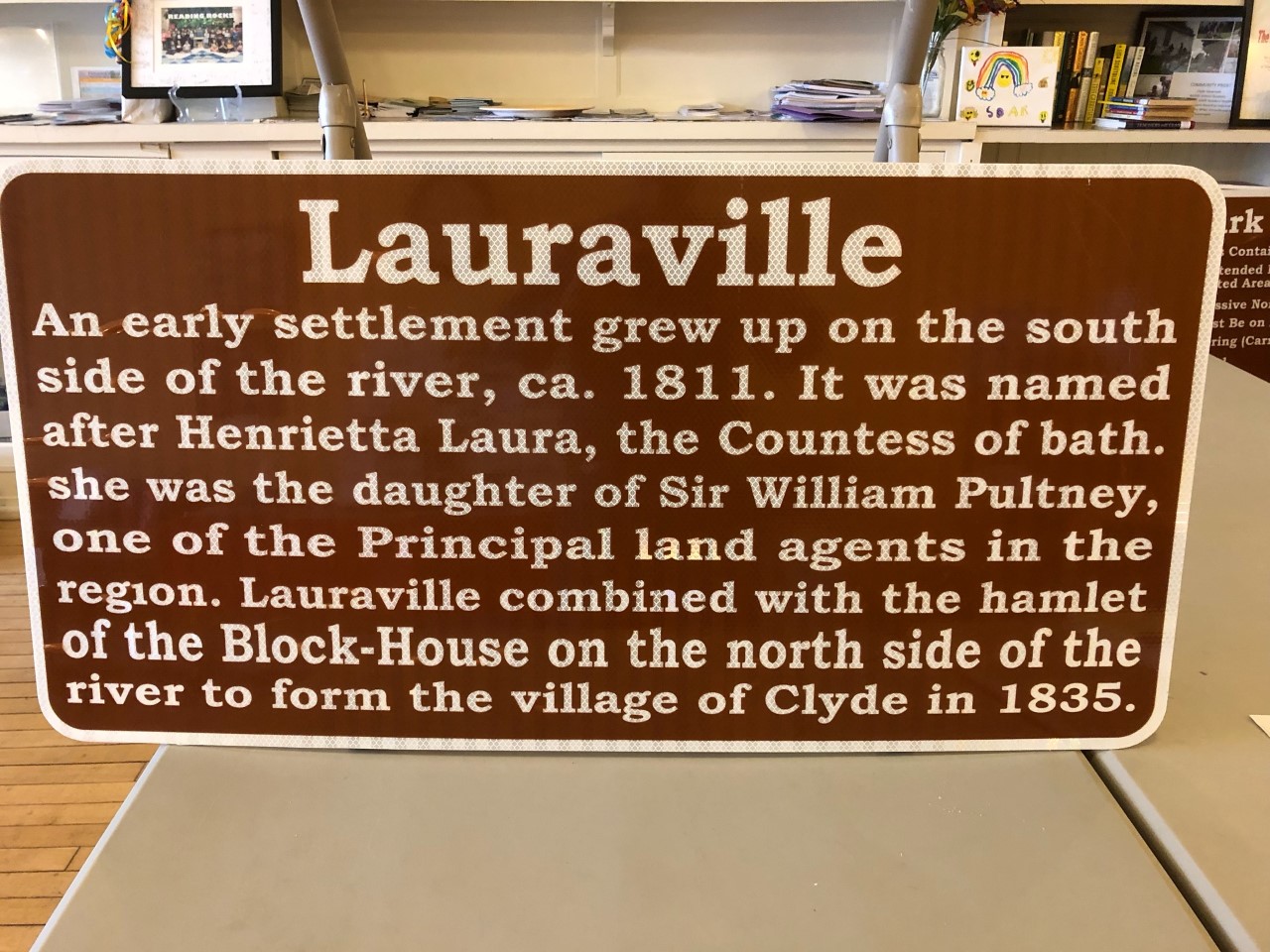
| The interpretive marker states: Lauraville An early settlement grew up on the south side of the river, ca, 1811. It was named after Henrietta Laura, the Countess of Bath. She was the daughter of Sir William Pultney, one of the Principal land agents in the region. Lauraville combined with the hamlet of the Block-House on the north side of the river to form the village of Clyde in 1835. | |||||